Shapefile CLI v1.4 Released
- 2020-02-07
- Ginkgoch
Today, I made a new release of my old project node-shapefile-cli with a set of new features for better experience; upgraded the Ginkgoch Map Library for better performance and more precise vectors.
A shapefile is a simple, nontopological format for storing the geometric location and attribute information of geographic features. Geographic features in a shapefile can be represented by points, lines, or polygons (areas). The workspace containing shapefiles may also contain dBASE tables, which can store additional attributes that can be joined to a shapefile’s features.
Installation
1 | yarn global add ginkgoch-shapefile-cli |
Change Logs v1.4
Upgrade the core implementation, better performance and accurate result.
Add a new feature to re-project a shapefile to a new shapefile with a specified CRS.
Add
servecommand to launch a server to browse Shapefile information on browser.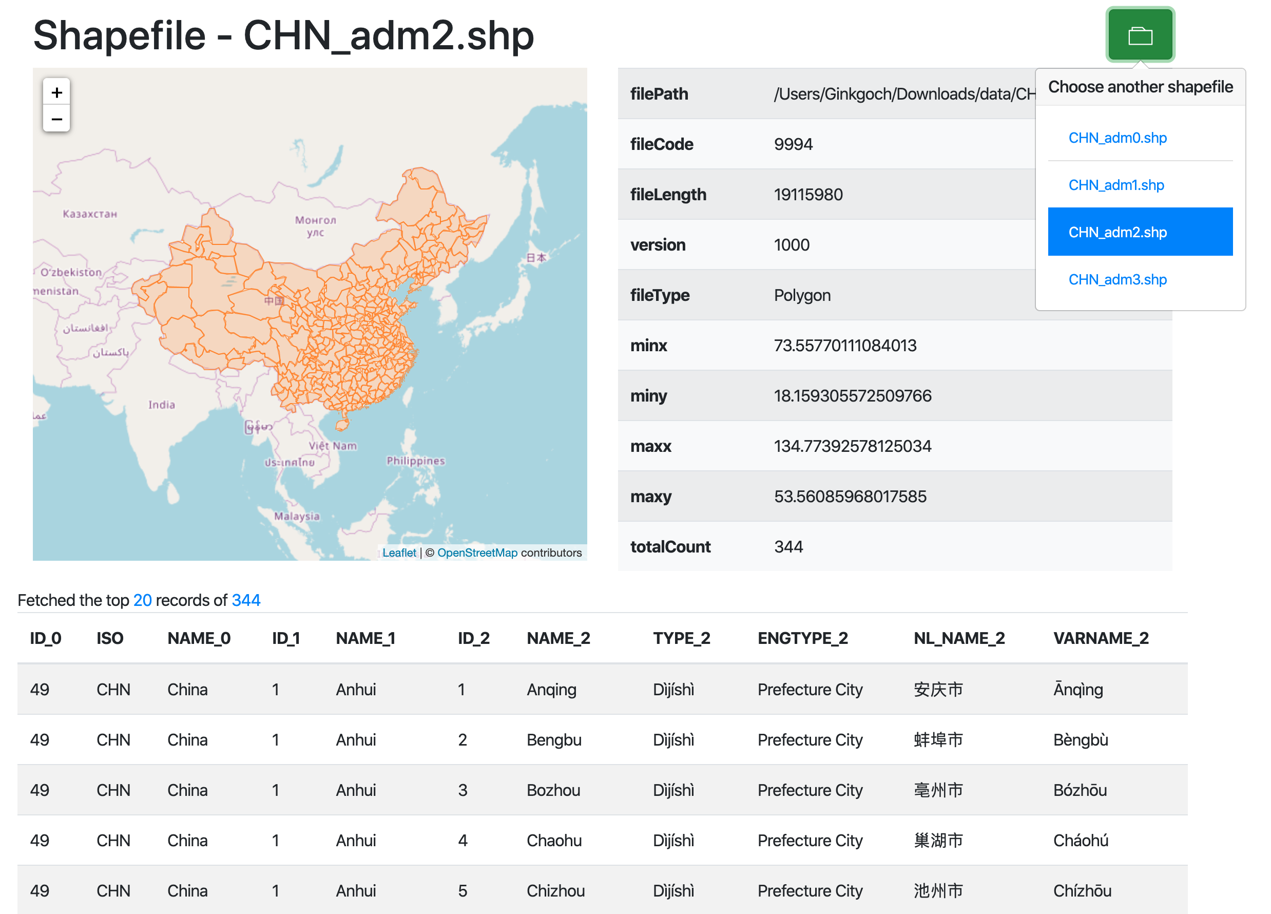
Add
build-indexcommand to build spatial index file for a corresponding shapefile. The index files provide better query performance for upper-level application that is build by Ginkgoch Map Library.Some minor bugs fix.
History Change Logs
- Add
show-headerto print Shapefile with table or JSON format. - Add
show-fieldsto print Shapefile fields information with table or JSON format. - Add
show-recordsto print Shapefile records. It also provides filter to reduce the print record count. - Add
convert-geojsonto convert shapefile to GeoJSON format.
Project Repository
https://github.com/ginkgoch/node-shapefile-cli